Mostly unpopulated, these islands offer even more variety; from forested bird sanctuaries to view across the water, to picnicking or sunbathing on sand islands. No need to escape to distant lands, they’re right here on our doorstep. There are also several islands, particularly in Brisbane Water, that are not named on popular maps – such as Wilsons Island – that are not accessible to the public.
PELICAN ISLAND, Tuggerah Lake
Characteristics: This is one of a group of four islands that lie between the northern and southern sections of Wyrrabalong National Park.
Size: Not stated.
History: Pelican Island was formed in the 1920s, the result of sand dredging in The Entrance Channel.
Why you’d visit: In the 100 years since its creation, a swamp oak forest now covers the higher ground, with saltmarsh mangroves and sedgeland around the island’s perimeter. Pelican Island was declared part of Wyrrabalong National Park in 1991 and is a breeding site for migratory wading birds. Access is limited.
SARATOGA ISLAND, Saratoga
Characteristics: This island off the western tip of the Saratoga Peninsula scrapes in as an island by the skin of its teeth at high tide.
Size: 2 hectares
History: It was formed from spoil created by the dredging of a sandbar during the early part of the 20th century. In the 1960s, sand from the island was also used to fill part of the wetland for the construction of a playing oval. A deep hole at the southern end of the island remains as evidence of the dredger’s work.
Why you’d visit: Swamp oaks (part of an endangered swamp oak floodplain forest) and mangroves have successfully populated the island. The sandbars on the southern side of the island are significant high-tide roosts for wading birds, a habitat that is scarce in Brisbane Water – so people access is discouraged. The mangroves, too, pose a threat to the waders because the vegetation provides a sneaky approach for foxes, dogs and cats.
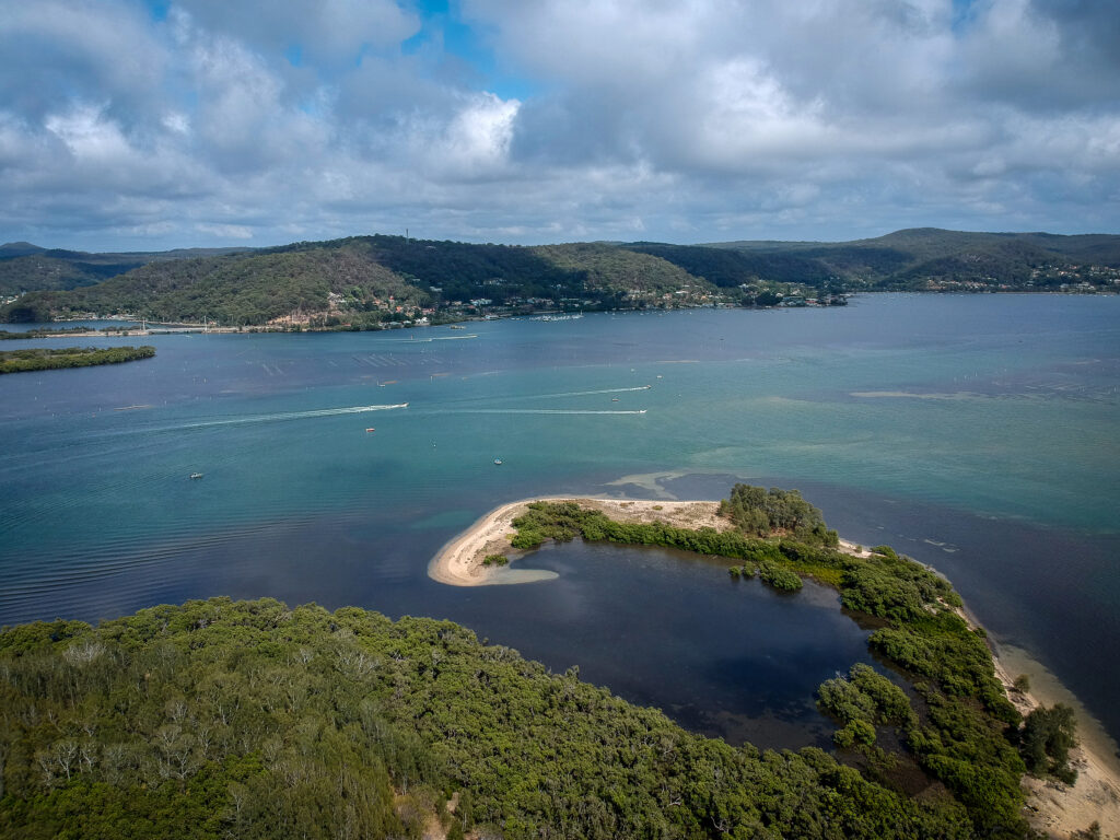
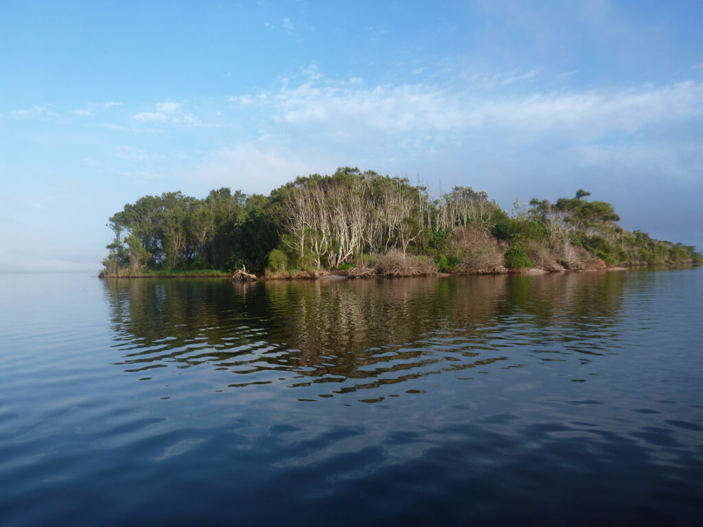
RILEYS ISLAND, Brisbane Water
Characteristics: One of the three large islands in Brisbane Water, it lies across ‘The Gutter’ from St Huberts Island and was formed by tidal movements carrying sand deposits. It is low-lying with a large expanse of mangrove swamp around its perimeter and dry sclerophyll forest inland.
Size: 19 hectares, with the 46-hectare Rileys Island Nature Reserve extending into the inter-tidal zone.
History: Originally known as Shell Island by the early European settlers, it was bought by John Riley in 1855 for £104.17s.6d. The family farmed cattle and grew bananas using seaweed for fertiliser. In the 1860s, at least two ships were built on the island. The Rileys sold to Donald Daisley in the 1940s and, in the 1960s, Hooker-Rex purchased it, planning to build 300 homes and link it by bridge to St Huberts. Over 500 environmentalists, biologists, anglers, nature lovers and Spike Milligan protested against the threat of ecological damage. The island was saved and gazetted as a nature reserve in 1989.
Why you’d visit: As a nature reserve, it’s best viewed from across the water. Look for 12 different species of microbats, noisy waterbirds and waders including cormorants, egrets, godwits, sandpipers and white- bellied sea eagles.
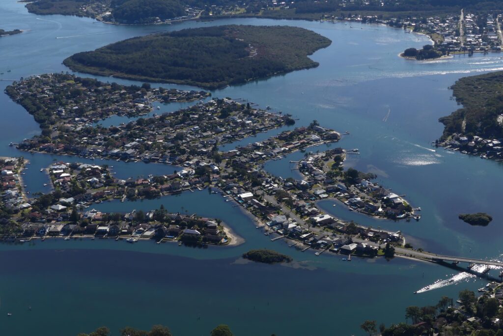
ST HUBERTS ISLAND, Brisbane Water
Characteristics: Originally an island much like its forested neighbour, Rileys Island, it has been developed into a residential, canal estate popular for its waterfront dwellings and boating access.
Size: 0.6 sq km.
History: St Huberts was connected to the mainland by a bridge in the early 1970s at Daleys Point when Hooker-Rex Developments reclaimed the island’s inter-tidal wetlands by raising the land above water level, creating canals to build numerous waterfront properties.
Why you’d visit: Check out the real estate and the views, as well as holiday Airbnbs.
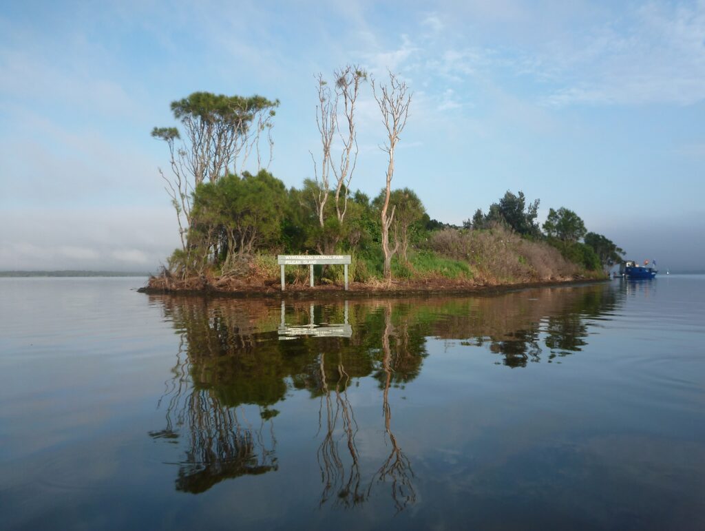
PELICAN ISLAND, Brisbane Water
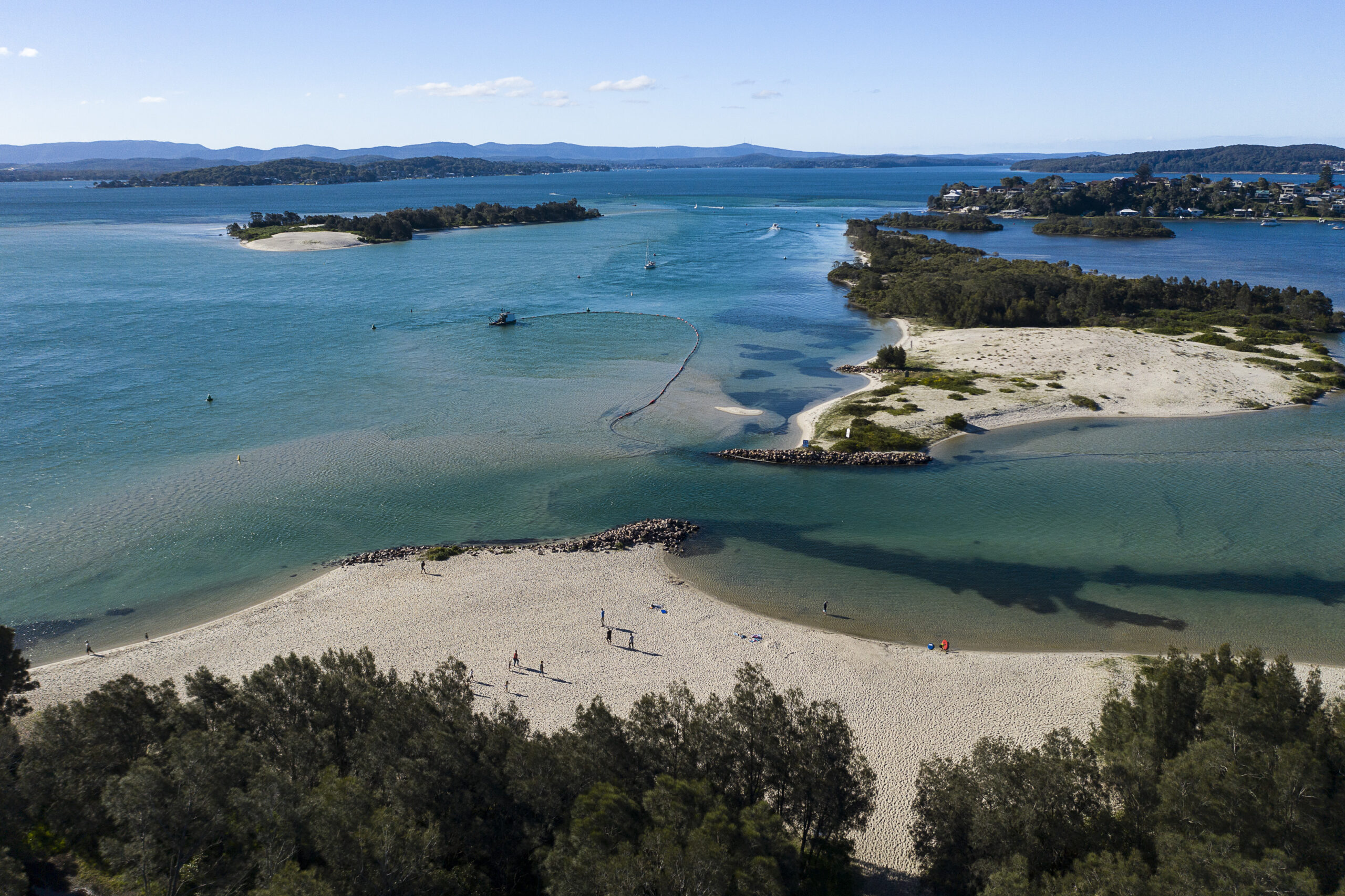
Characteristics: Pelican Island Nature Reserve is actually three islands separated by mangrove channels. You’ll find the islands just across from the Woy Woy ferry terminal and sitting half a metre above sea level. Although named Pelican Island, the local pelicans prefer a more exposed sandbar islet in the area to breed upon, raise their chicks and call home.
Size: 40 hectares.
History: The islands are said to have been formed as the result of the maintenance work in the channel separating them from Woy Woy and by the sediment flow from the construction of the Brisbane Water Drive and railway line causeway.
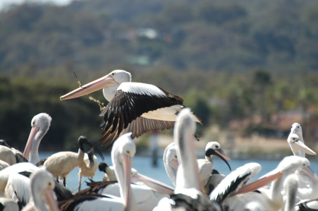
Why you’d visit: The largest population on the island may well be mosquitoes, but the waters around it are a haven for kayakers to watch pellies, corellas, cormorants, black swans and more.
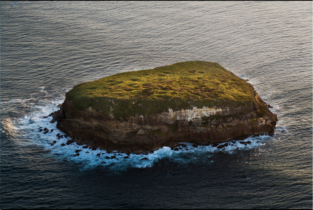
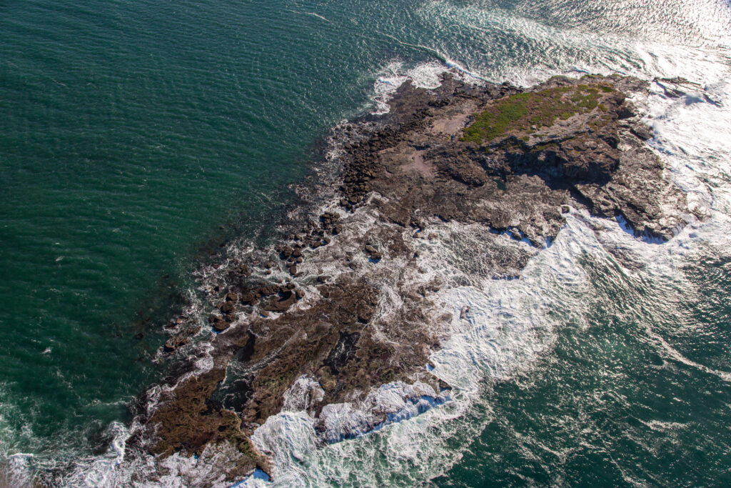
BIRD ISLAND, Tasman Sea
Characteristics: Lying 1.4 km off Budgewoi Peninsula, the island is known for its birdlife, unusual variety of Sydney golden wattle, coastal tea tree, pigface and open heathlands.
Size: This circular island is not more than 260 m across and rises to a height of 20 m above sea level.
History: It was part of the mainland 6,000 years ago and, before the advent of the lighthouse at Norah Head, the area around it had claimed a number of shipwrecks.
Why you’d visit: The island is a protected nature reserve with up to 7,000 pairs of shearwaters breeding on the island, as do the threatened sooty oystercatchers and around 20 other species of birds. Its rocky cliffs fortunately make access difficult for flightless humans.
TERILBAH ISLAND, Tuggerah Lake
Characteristics: Located opposite Terilbah Reserve at North Entrance, it is the largest of four islands in the lake and is the only naturally formed sand island.
Size: 1.5 km long.
History: In 1991 it was declared part of Wyrrabalong National Park.
Why you’d visit: The island is a breeding site for migratory wading birds so access is discouraged. The vegetation is mainly swamp oak, with taller eucalypts and tuckeroos growing inland. The vegetation communities on the islands are all listed as Endangered Ecological Communities, and NSW National Parks & Wildlife has been trying to rid the island of asparagus fern and bitou bush.
LAKE MACQUARIE SAND ISLANDS
Characteristics: Lake Macquarie is the largest coastal lake in Australia and twice a day, the tides spill through the Swansea Channel washing sand back and forth, creating channels, banks and bars. Most noticeable, are the sand islands: Elizabeth, Pelican and Spectacle.
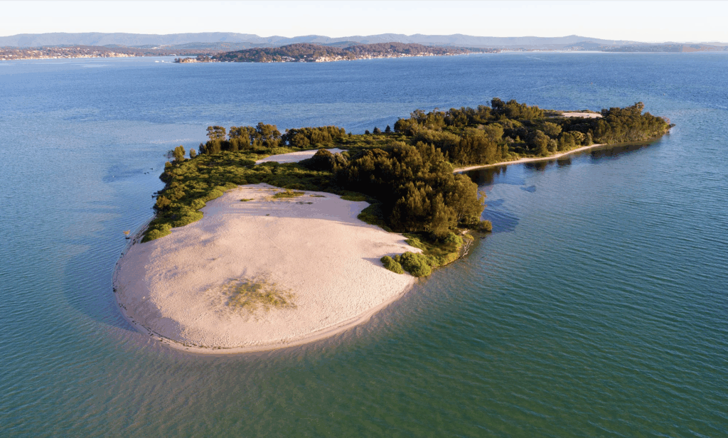
ELIZABETH ISLAND, Lake Macquarie
Why you’d visit: Accessed by boat, this is a beautiful camping and swimming spot (dogs allowed). There are no toilet facilities or garbage bins so BYO portable facilities. The southern end of the island has a large sandhill. You’ll find morning shade on the western side, and afternoon shade on the eastern side of the island. Avoid the northern end whenever the lake is being dredged because of the pipes and machinery obstructions.
SPECTACLE ISLAND and PELICAN ISLAND, Lake Macquarie
Why you’d visit: Accessed by boat, these two tiny islands are part of a popular kayak and paddleboard route across the lake between Spectacle and Pelican islands to Marks Point. Pack a picnic and find a sheltered, pristine white sandy spot beside the turquoise waters.
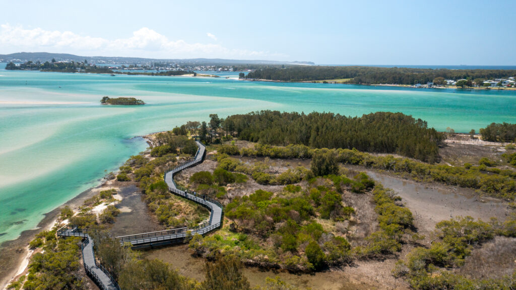
PIRRITA ISLAND, Swansea Channel
Characteristics: Situated at the northern end of the Swansea peninsula across from Spectacle Island and is surrounded by relatively shallow waters. Confusingly, Pirrita Island Nature Reserve is not part of the island but on the opposite mainland at Miners Point.
Size: 9.3 ha.
History: The name means ‘oysters on the mangrove trees’ in the Awabakal language. Europeans originally called the island ‘Coon Island’ after its first resident, Herbert ‘Coon’ Heaney, so named for the coal dust he bore on his face or, perhaps because the word is offensive, it’s also been said he resembled a racoon and was therefore nicknamed ‘Coon’.
Why you’d visit: You’re much more likely to visit the Pirrita Island Nature Reserve, which has a stunning, accessible boardwalk that winds through the lakeside mangroves. There are great views of the lake and neighbouring islands, walking trails and an abundant birdlife. As well as a viewing platform, the reserve has BBQ facilities, picnic tables, shelters and toilets. It’s accessed from Dobinson Drive, Swansea.
MOON ISLAND, Lake Macquarie entrance
Characteristics: No more than a fairly flat rock off Lake Macquarie, it has a reef that extends from its eastern end and is honeycombed with caves. The island is an important roosting site for sooty oystercatchers, wedge-tailed shearwaters, seagulls and is visited by resting little penguins and seals. The Awabakal name for Moon Island is ‘Nirritiba’, a place of mutton birds.
Size: 1 ha.
History: Its history is intertwined with that of Lake Macquarie, which was called Reid’s Mistake for a quarter of a century, after Captain William Reid who, in 1800, thought Moon Island was Nobby’s Island and that he was at the mouth of the Hunter River. He loaded his ship with coal from a seam on the southern headland, still thinking he was in the Hunter River. He thereby inadvertently opened up both the local coalfields and the lake.
Why you’d go there: Accessed by a 10-minute boat ride from the Swansea Bridge, it is a popular dive site with arches to swim through, caves and rocky shelves to explore, or just drift down the side of the rock to explore soft and hard coral beds and marine life. Weedy sea dragons live in the kelp beds. Turtles, wobbegongs, bull rays, grey nurse and Port Jackson sharks visit the caves and ledges.
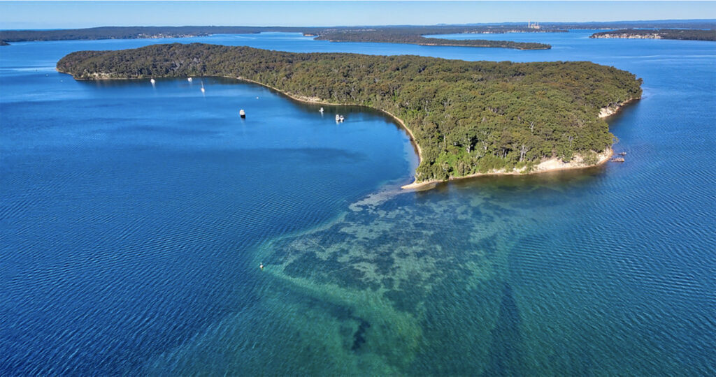
PULBAH ISLAND, Lake Macquarie
Characteristics: Located in the southern area of the lake, the island is also referred to as ‘Boroyiroong’ or ‘Bulba’, an Indigenous word for island. The Awabakal people consider it a sacred place. It was home to Wau-wai, a monster fish that terrorised the locals.
Size: 1.6 km long and 70 ha over all, making it the largest island in the lake.
History: Europeans introduced rabbits and quail to the island for hunting and in the early 1870s a sawmill was built to process the spotted gum and blackbutt timber. As the timber felling gave way
to grasslands, cattle were swum or rowed to the island for grazing, and concrete water tanks were built to supplement the scarce water supply. Intriguing tales surround the local name for the island, ‘Bury-Your-Own’. In 1929, the island was declared a reserve and today it is part of the Lake Macquarie State Conservation Area.
Why you’d go there: There are safe anchorages on the northern side of the island, but there are no facilities on land. Visit for the natural beauty and wildlife. It is a refuge for koalas, wallabies, sugar gliders and a wide range of birds including white-bellied sea eagles.
Main image courtesy Lake Macquarie Council
For more see Part 1 of Islands of our Waterways: the Hawkesbury River and Broken Bay.